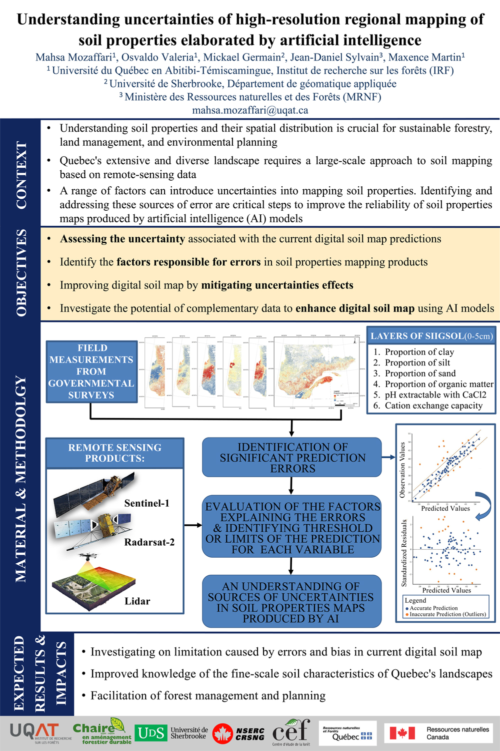
Understanding soil properties and their spatial distribution is crucial for sustainable agriculture and forestry, land management, and environmental planning. Quebec's extensive and diverse landscape requires a large-scale approach to soil mapping to foster environmental challenges. Remote sensing technologies, such as satellite imagery, have shown off an exponential increase in the precision and quantity of data that gives, valuable insights into soil properties at a provincial scale. Machine learning methods, including deep learning algorithms, have evolved to process and analyze this wealth of data, offering the potential for more accurate and comprehensive soil mapping. A range of factors can introduce uncertainties into predictions. For instance, the complex, the size and diverse terrain of Quebec presents challenges in accurately mapping soil properties. Identifying and addressing these sources of error are critical steps to developing strategies to mitigate them and improving the reliability of soil properties maps. Therefore, this research explores the application of artificial intelligence (AI) to enhance the precision and reliability of high-resolution regional soil properties mapping. We will also focus on assessing the uncertainty associated with these predictions. In this way, we will utilize the SIIGSOL dataset as the reference map, comparing it with ground truth data from provincial and federal government to evaluate accuracy, and subsequently analyze the results of this comparison to identify the factors responsible for errors in soil properties mapping. In addition, we will investigate the potential of complementary data to enhance SIIGSOL using AI models. Through this research, we intend to provide soil data of high relevance that will increase the effectiveness of land management measures, thereby contributing to the sustainable development and environmental planning in Quebec.